It's funny how some of the most amazing experiences you have you just happen to stumble upon. Such was our experience with Raven Rocks. We awoke Monday morning with absolutely no plans. As I started my morning routine of coffee, getting dressed, etc. I had the anxious feeling that since it was nice weather (read: not in the 90's and slightly overcast) that we were "wasting" the day if we didn't go outside and do something (hike). I somewhat randomly decided to Google "Bluemont hikes." Why Bluemont? Well, a while ago my best friend had sent me a photo of her daughter on a hike by a waterfall that looked pretty, and all I knew about it was that it was in Bluemont, so I thought I'd just try a search and see what I could come up with. The first hike that popped up was Raven Rocks on the Appalachian Trail. I quickly skimmed over the All Trails entry: 5.3 miles (check), good for kids (check), out and back (alright). It also said something like locals call it "the roller coaster", rocky, moderate to strenuous. I told my husband I'd found a 5 mile hike off the Appalachian Trail and that we should get ready. He was game. We hurried, packed snacks, rounded the boys up, and headed out. It is always best to get to these places sooner in the day rather than later. Generally, the parking lots are small at AT trail heads, you want to get out before the heat of the day, AND especially these days, there are MANY less people the earlier you go.
I will say, this hike and the payoff were well worth the effort. It is not a hike for beginners, it's Moderate to Strenuous ranking was accurate. It is rocky and there are many ups and downs. Pack plenty of water (or electrolyte drink in the summer) and snacks (we were ravenous after returning to the car where the rest of our food was. Bring more than you think you need for a 5 miler.) I would say that while it is o.k. for children, I wouldn't recommend it for super young ones, and it's probably not ideal for children (or adults!) that aren't used to hiking.
I absolutely loved it. The terrain provided a great, engaging experience. You had to pay attention to where you were walking most times and become so focused on the task that you aren't constantly thinking about mileage, or how much further you have to go, when you are going to have your next snack, or your to-do list back at home, etc. It provided an actual workout, without being deadly. Yes, there were steep parts, but it wasn't straight uphill the entire time. Actually, given the "roller coaster" nature of this hike, you climb- working one set of muscles, and immediately descend- working the opposing muscles. It gives your lower back a break, too 👍-bonus. I'll say this, my legs were sore that evening, and that is saying a lot for a 5 mile hike.
This ascent is right out of the parking lot. The climb starts immediately.
And yes, the terrain really is this rocky on a good portion of this hike.
The boys, especially my youngest, really loved climbing all over the rocks that were right off the trail.
This clambering is actually on the trail.
But yes, he really enjoyed the rocks (Future Climber? Fingers crossed😉)
A preview of the view to come.
In the fall/winter, I would imagine you'd have a spectacular view the majority of the hike.
My son wanted to photograph an interesting caterpillar.
I haven't been able to figure out what kind it is.
If you know, or have a guess, please let me know.
And of the grasshopper (this photo doesn't do its size justice. It was big!)
He loved the little inchworm making its way up his leg 🐛
Not an exaggeration that your ankles, calves, and legs will be worked from all angles.
Scarlet Tanager sighting- very exciting! It's a beautiful bird.
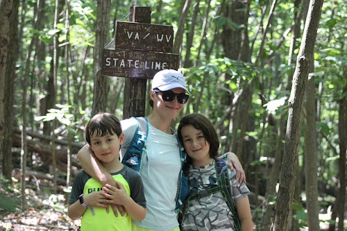
Cheese📷
Honestly, this made me laugh. The trail blaze was on a rock!
And what is funny, is that we almost turned back before the summit. We had no idea how close we were. The kids were tired after so many rocks, and so much up and down, that we stopped to rest and to have snacks by the water. I decided to check my phone to see how close we were (yay- for reception and Google Maps), and we were .4 miles away. Less than a half mile! Truthfully, what really sold everyone, especially my youngest son, was that you cross state lines. The summit is in West Virginia! Well, we had to carry on. It was worth it! When we reached Raven Rocks there were two college kids and thankfully they moved on quickly. Remarkably, we had the overlook to ourselves for a bit. We took lots of photos- many "frame" worthy.
Hey- yo!
Dad and Mom make an appearance😃
This one's a "Framer"


How exciting. Keep this blog going. The stories and photos are great! You guys may be ready for Old Rag soon.
ReplyDeleteThank you! Can't wait for the boys to explore Old Rag! That will be a milestone :-)
ReplyDelete