Today was the first full day of our second trip to the White Mountains of New Hampshire. I have been dreaming of returning since the moment we left this summer. I knew my husband had a week off of work in October and I thought it would be a wonderful time to go back. Once we decided to make reservations, I started buying and stashing non-perishable grocery items, preparing and freezing meals, heck, I even had the boys' and my suitcase packed a week in advance.
Our trip north went well, although we took an hour longer (11 hours as opposed to 10 this summer) and it was raining the entire drive. Luck would have it that when we drove in to Waterville Valley, the rain stopped, the sun came out and we were welcomed back with a beautiful rainbow. I took it as a good omen.
Once we arrived, we unpacked the car and went for a 5 mile walk along the Mad River, ate dinner, and went to bed dreaming of more adventures to come. The following morning we all woke up early and prepared to go for a hike. We were thinking of something in the 5 mile range and settled on a popular hike, the Welch-Dickey Loop with 2 peaks and spectacular vistas. It is described as Waterville Valley's most popular hike. When we pulled into the parking lot, it was PACKED. Cars, people, dogs everywhere. Nope. No. Not even in a non-Covid world. We did not even get out of the car before throwing it in reverse and getting the heck out of there.
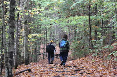
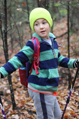
What now? We had passed a trailhead parking lot on the way out for Smart's Brook and decided to park there and consult our map. The Smart's Brook trail is roughly 5 miles, At the end you can join another trail where you can continue upward for another .6 to reach the Sandwich Dome or the summit of Sandwich Mountain. The problem is this trail isn't a loop, it's an out and back, so it would be roughly 12 miles of hiking. Double what we had intended. We decided to give it a shot as the trail was rated easy. It started out easy enough on a logging road and then headed into the Sandwich Wilderness where became a proper hiking trail. The trees were gorgeously colored, the woods smelled of pine and the hike started out wonderfully. But the miles dragged on, and it seemed to take forever at points. The first half of the ascent, I listened to my eldest complain about his leg for at least an hour. He sustained a leg injury by...wait for it...reading. Yes, reading. He was sitting in an awkward position and pulled a muscle getting up. Oy. So, yes, an hour plus of hearing about his leg. Then as we hiked higher and higher with no end in sight, Little Man, threw an absolute epic temper tantrum. Trees lost limbs, stones were thrown. I'm surprised his hiking poles weren't wrapped around a tree trunk, because that was direction we were headed. It turns out that at that point we were probably only a mile to the summit. But he had had enough. Honestly, it was taking forever (about 3and a half hours). When we finally reached the connecting trail we stopped for much needed snacks. Bribes were made (involving fudge pops (a special treat from our last trip)).
When we finally got up to press on, an older couple was coming down from the summit and W struck up a conversation with them (does this surprise anyone? 😉). The woman said the summit was "ok", "not a bald top (meaning trees obstructing the view)" and that it was "a little foggy." Not the news you want to hear. I was crestfallen. I have a lot of guilt in these circumstances. All that walking, and for what? Oh well. W let me go on ahead, he followed, and the kids stuck together in the back. The walk continued on...slowly. Mountain miles can drag on. Eventually, I passed a group of 4 descending. Much to my relief, they told me that I was very close to the top and that the fog had cleared! I practically ran the rest of the way. When I arrived, I was alone! It was gorgeous. Wind filled my sails again. I took it all in as I waited for my husband and the boys. W arrived first, and we actually had a moment to ourselves before the boys got there- gasp! When the boys arrived, N was carrying all of R's stuff. When we asked why, he said "I couldn't take his complaining anymore." HA! My reply, "it's tiresome listening to someone complain the entire time, huh?" He looked at the ground.
Both boys were happy to have made it to the top (it was a 3, 980ft summit- almost a 4,000 footer!) and were pleased to have seen the view and were in much better spirits descending the mountain. I think N's highlight of the day was when he slipped on a mossy bundle of roots and goofily saved himself, but I actually fell (they were very slick). I have never seen him laugh so loudly and so freely at his poor mother's expense. That giddiness propelled him down the mountain leading the way. It was a full day. A 9:00-5:00-er. I think we squealed when we returned to the parking lot some 4 hours after being at the summit😵 We returned home pleasantly, thoroughly exhausted- the best feeling ever, in my opinion.


The reading part made me laugh! Glad you made it back!
ReplyDeleteSuch a N injury *shakes head*
ReplyDelete
ReplyDeleteSounds like an interesting start to your trip. Great views and I'm sure there are more to come!
If by "interesting" you mean "long" than yes- ha, ha!
ReplyDelete